Flooding has been a major problem in parts of Saskatchewan for the past several years, increasing as climate change worsens and endangering many communities. For some community leaders, the easiest solution is simply moving the problem from one area to another, and this is what the Quill Lakes Watershed Association, representing many communities in the Quill Lakes area, would like to do with their proposed 25-kilometre drainage diversion channel to redirect surface water from Kutawagan Lake and Pel Lake to Last Mountain Lake, around 40 KM northwest of Regina.
The Government Of Saskatchewan approved the project with no environmental impact assessment, claiming one isn't needed despite such assessments being standard for projects smaller than this one.
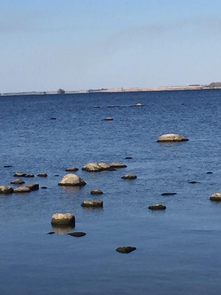
The Pasqua First Nation and many people near Last Mountain Lake see the project as dangerous ot the local watershed, and have been trying to stop the project in court.
As one local activist explained the problem;
"The proposed drainage diversion channel redirecting water from Kutawagan Lake and Pel Lake towards Last Mountain Lake poses a direct threat to the wildlife contained within this habitat as well as all habitats downstream. Last Mountain Lake is a world class angling destination and the introduction of millions of liters of saline water contaminated with pesticides and other toxic elements jeopardizes this."
A more complete explanation of the problem comes from Last Mountain Lake Stewardship Group;
Last Mountain Lake is once again being threatened by a plan to drain highly polluted water from the Quill Lake area. You may recall the Kutawagan Creek Diversion Project in 2015 when Water Security Agency, (WSA), proposed a plan to divert water from the Quill Lakes, through Kutawagan Basin and downstream to Last Mountain Lake. Public meetings were held in several community halls promoting the diversion project. However, due to public pressure, citing the impact this diversion would have on the water quality and water levels of Last Mountain Lake, the provincial government cancelled the project.
Subsequently, the Quill Lake Watershed Association #14 (QLWA) was formed by local farmers and rural municipalities in the Quill Lake area. They were given authority by the provincial government to own, operate and maintain projects; raise funds from local landowners; borrow funds; and expropriate land to build drainage projects.
The KGS Group Consulting Group was retained to complete a study on flood mitigation options that would address the rise of water levels in the Quill Lakes. The report contained six mitigation strategies with two or more options in each. You can log on to https://www.wsask.ca/About-WSA/QuillLakes/ for the Flood Mitigation Report. The strategy chosen by the QLWA was the Removal of Water from Quill Lakes. Five options are listed in the report that can be used for removing water from the Quill Lakes. QWLA chose only two of those options: 1) Divert water downstream to Last Mountain Lake, (Landowner Plan B); and 2) Deep Well Injection.
The plan to remove water from the Quills is to construct a diversion channel in the Kutawagan Complex from Pell Lake south towards Peter Lake and Last Mountain Lake. A control structure would be constructed that would regulate the flow downstream to Last Mountain Lake. Several creeks that naturally flow into the Quill Lakes, would be redirected into the channel. Up to 33% of “fresh” water runoff from the Quill Lakes would be temporarily stored and released downstream, “only if and when there is room in their systems”.
This plan is being presented by QWLA as ‘fresh water’ diversion. The Last Mountain Lake Stewardship Group (LMLSG) does not agree. They defined fresh water as “spring runoff water from agricultural lands that has not been mixed with the higher TDS water of Big Quill Lake”. (Total Dissolved Solids [TDS]). However, the QLWA also reported that “Ironspring and Romance creek systems, Jansen Lake and the runoff water in general from our area was mostly between 600 and 900 TDS, far lower than Last Mountain Lake”. Fresh water is defined as having from 0-500 mg/l TDS. (Saline Lake Resources of the Canadian Prairies. [U. Theopdore Hammer]). So before this water even leaves the creeks, it is considered subsaline water, not fresh water. Once the water runs its course through the Kutawagan Basin, Saline Creek and Peter Lake, and through heavily fertilized farmland where additional pollutants would be picked up and absorbed along the way, TDS concentration would be much higher than indicated above.
WSA reported that “an assumption made in the QLWA application is that water quality in the area is fresh (Pell and Kutawagan lakes and surrounding unnamed water). This assumption is incorrect”.
It appears their (QLWA) logic, by separating the Kutawagan Channel from Big Quill, will insure the “best quality diversion runoff downstream”. The volumes of water in the spring runoff would dilute the Kutawagan Basin as it flows through, improving water quality with each new runoff or rain event. Although higher volumes of water flow through waterbodies could reduce TDS levels, lower volumes of water flow could increase TDS levels.
Salinity in Pell Lake is presently similar to or greater than that in Big Quill Lake, 9,000 to 11,000 mg/l TDS. Kutawagan Lake is about 5,830 mg/l TDS. Last Mountain Lake has TDS of 1400 mg/l. This project is based on assumptions and predictions and there is far too much at stake to rely on assumptions and predictions. Water quality in Last Mountain Lake is at risk. The increase in saline can be deadly to fish and aquatic life. Excessive nitrogen in the water will increase the number and intensity of algae blooms in Last Mountain Lake.
The Wildlife Bird Sanctuary, located at the north end of Last Mountain Lake, will be largely affected by this diversion plan. Since 1887 this area has been a protected wetland for over 280 species of birds during migration. It is the first federal bird sanctuary in North America and has been officially recognized as a special place for wildlife due to its good habitats, as one of the most productive lakes in southern Saskatchewan; and its strategic location in the heart of the central flyway of North America.
It is stated in the KGS report that, “we are dealing with a once in a 2000 year natural event. We can make every effort to preserve fish habitat integrity. If we can’t, restocking and recovery will be a lot faster and inexpensive than the loss of the economic upstream infrastructure that will pay for downstream mitigation”. These statements are unbelievable! Any plan to divert water into Last Mountain Lake that is heavily polluted with saline will permanently alter the quality of our lake water and cannot be reversed.
LMLSG recommendations to solve the Quill Lakes flood problem are as follows:
Drainage Enforcement: Close all agricultural drains on the land around the Quill Lakes immediately, and prohibit any new drainage operations. The practice of draining agricultural land into the Quills has contributed to the high lake levels. Over the years, this practice has changed the overall natural water flow in the area.
Upland Storage Options: Twelve potential upland storage areas, identified in the KGS Report, would maximize surface area upstream of the Quill Lakes to increase evaporation, thereby reducing inflows to the lakes.
Withdraw Water for Potash Mines: Develop a long term solution by creating a partnership with the BHP Jansen Lake Mine or the Karnalyte Potash
We have not received any information from QLWA regarding the Deep Well Injection mitigation strategy mentioned above. It would appear the only option being considered is the removal of water from the Quills into Last Mountain Lake.
Wetlands, often referred to as sloughs and marshes, are low-lying land areas covered by water that support aquatic plants, bushes and wildlife. They serve as storage spaces and act as a sponge, soaking up excess runoff. Wetlands are an important part of our eco system but are gradually disappearing from the prairies due to agriculture and urbanization. According to the KGS report the estimated volume of drained wetlands in the Quill Lakes Watershed is 143,576 cu dams.
It is apparent that the basic problem to the flooding in Quill Lakes is “illegal drainage”. Because drainage accounts for 38%, the 7m rise in lake levels would then only be 4.3m. The lakes would not be flooded and infrastructure would not be destroyed or need to be raised, and this environmental disaster would not be happening at the lakes. Effective October 1, 2016 WSA was given authority to close all unapproved drainage works, or impose penalties on landowners who did not comply. To date WSA has not issued a single fine for illegal drainage.
This diversion project affects not only the landowners at Quill Lake, but also residents of Last Mountain Lake and residents in the Qu’Appelle Lakes area. It is imperative that all stakeholders be included in developing a solution. The proposal to divert water that is loaded with TDS, (saline, nitrogen etc.), downstream into Last Mountain Lake is just one more step in causing long term damage to a healthy natural resource.
The vision of the Last Mountain Lake Stewardship Group is “To Sustain and Enhance Our Lake for Future Generations”. If that is your vision also, if you want your children and grandchildren to enjoy the same recreational activities as you do, please make your opinion known by contacting Honourable Scott Moe, Minister Responsible for Saskatchewan Water Security Agency. You are an important stakeholder and deserve the right to voice your opinion and concerns.
Submitted by: Sherry Forsyth
On Behalf of the Last Mountain Lake Stewardship Group"